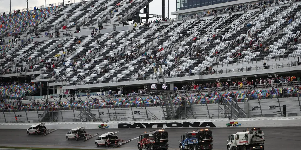
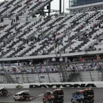
The final laps of the Daytona 500 unfolded under darkening skies Sunday as severe thunderstorms pushed across parts of Florida.
Strong winds and heavy rain developed late in the day, prompting warnings from the National Weather Service while thousands were still near Daytona International Speedway.
Forecasters said damaging wind gusts were the primary concern, with scattered power outages and hazardous travel conditions reported in some areas.
The timing raised safety concerns as fans exited the venue and traffic intensified across Volusia County and surrounding communities.
Key Facts at a Glance
| Event | Location | Date | Who Is Affected | Current Status | What Readers Should Know |
|---|---|---|---|---|---|
| Severe Thunderstorms During Daytona 500 | Daytona Beach, Florida | February 15 | NASCAR fans, residents, travelers | Storm system moving east; warnings lifted in some areas | Damaging winds were the main threat; monitor local forecasts for updates |
| Weather Service Alerts | Central and East Florida | February 15 | Drivers, businesses, event attendees | Some advisories remain in place | Isolated outages and debris reported |
Severe Thunderstorm Warnings Issued Near Daytona Beach
The National Weather Service issued severe thunderstorm warnings Sunday afternoon as a line of storms moved across central Florida.
Meteorologists warned that wind gusts could exceed 60 mph in some pockets. The strongest cells tracked near Daytona Beach just as the Daytona 500 was concluding.
“These storms are capable of producing damaging wind gusts and heavy rainfall in a short period of time,” a National Weather Service meteorologist in Melbourne said in a public statement. “People traveling after the race should use caution and avoid flooded roadways.”
While lightning and brief downpours were common, forecasters emphasized that straight-line winds posed the greater risk.

Daytona 500 Crowd Faces Sudden Weather Shift
The Daytona 500, one of NASCAR’s biggest events of the year, draws tens of thousands of fans from across the country.
Weather conditions earlier in the day were mostly manageable, though forecasters had flagged the potential for storms later in the afternoon.
As the race ended, radar showed intensifying storm cells approaching from the west.
Fans leaving Daytona International Speedway encountered gusty winds, heavy rain, and quickly changing visibility. Some reported delays while exiting parking areas.
“We knew storms were possible, but the wind picked up fast right as everyone started heading out,” said Mark Ellison, a fan from Georgia who attended the race. “You could feel the weather change almost immediately.”
Emergency officials urged drivers to slow down and remain alert for debris on roadways.
Timeline: How the Storm System Developed
Morning Forecast
Forecasters had predicted an unstable air mass over central Florida, fueled by daytime heating and moisture from the Gulf of Mexico.
The Storm Prediction Center placed portions of the region under a marginal to slight risk for severe weather.
Early Afternoon
Cloud cover increased through midday. Radar began showing scattered showers west of Daytona Beach.
Late Afternoon
A more organized line of storms developed and moved eastward. Severe thunderstorm warnings were issued for parts of Volusia County shortly before and during the race’s conclusion.
Evening
The strongest storms moved offshore by evening, though scattered showers lingered along the coast.
Reports of Wind Damage and Power Disruptions
Local authorities reported isolated tree limbs downed by strong gusts. Utility crews responded to scattered power outages affecting small clusters of customers.
No widespread structural damage was immediately reported Sunday evening.
A Volusia County emergency management spokesperson said crews were monitoring conditions closely.
“At this time, we are seeing minor impacts, primarily related to wind,” the spokesperson said. “Residents should remain cautious as additional showers move through.”
Officials did not report serious injuries tied directly to the storm as of late Sunday.
Travel and Traffic Concerns After the Race
Major NASCAR events often create heavy congestion around Daytona Beach.
The sudden onset of strong storms complicated traffic flow as thousands of vehicles left the speedway at once. Reduced visibility and ponding on roadways slowed movement in several areas.
Law enforcement increased patrols to assist with traffic control and monitor for accidents.
Authorities reminded drivers not to attempt to cross water-covered roads and to allow extra time for travel.
Why This Storm Matters
Florida frequently experiences afternoon thunderstorms, especially during warmer months.
However, large outdoor events can amplify the impact when severe weather develops during peak crowd movement.
Rapidly changing conditions, high winds, and heavy rain can create dangerous travel scenarios, even if storm duration is brief.
Weather officials stressed the importance of checking forecasts before and after major public events.
What Happens Next
The storm system continued moving eastward Sunday evening, gradually weakening over the Atlantic.
Forecasters expect calmer conditions to return overnight, with cooler, drier air settling into parts of the region early in the week.
The National Weather Service will continue monitoring for any additional developments.
Residents and visitors are advised to review updated forecasts and remain alert for lingering advisories.
Frequently Asked Questions
Was the Daytona 500 delayed due to storms?
The race concluded before the most intense storms reached Daytona Beach. However, severe weather developed as fans were leaving the venue.
What type of severe weather occurred?
The primary threat was damaging straight-line wind gusts. Heavy rain and lightning were also reported.
Were there injuries reported?
As of late Sunday, officials had not reported serious injuries directly linked to the storms.
Did the storms cause power outages?
Yes, scattered outages were reported in parts of central Florida due to wind-related damage.
Are more storms expected this week?
Forecasters expect calmer conditions early in the week, though Florida weather can change quickly. Residents should monitor local forecasts.
What should drivers do during severe thunderstorms?
Slow down, increase following distance, avoid flooded roads, and remain aware of falling debris.
Closing
Severe thunderstorms moved through central Florida just as the Daytona 500 wrapped up Sunday, bringing strong winds and heavy rain to the region.
While impacts were limited, the timing highlighted how quickly weather conditions can shift during large public events.
Authorities continue to monitor conditions, and residents are encouraged to stay updated on local forecasts in the days ahead.

Leave a Comment