
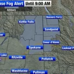
Fire danger is expected to ease on Wednesday, offering some relief after recent elevated conditions.
Forecasters say lighter winds and stable temperatures will help lower the overall wildfire risk, even as warm, dry weather continues across the region.
Daytime highs are forecast to reach the low to mid-70s on Wednesday, with overnight lows dipping into the mid-40s. Skies will range from partly cloudy to mostly sunny.
The calmer weather pattern matters for communities in fire-prone areas, where wind speed and dry air can quickly increase wildfire spread potential.
Wednesday Forecast: Lower Fire Danger With Light Winds

According to the National Weather Service, fire danger levels often depend on a combination of wind, humidity, and recent rainfall.
On Wednesday, winds are expected to remain light, shifting from the south to east at around 5 to 10 miles per hour.
Temperatures will rise into the low and mid-70s during the afternoon, creating mild conditions typical of early spring patterns in many parts of the country.
Overnight lows will settle into the mid-40s, limiting extreme drying overnight.
A meteorologist with the National Weather Service said lighter winds play a significant role in lowering wildfire risk.
“When winds stay below 10 miles per hour, the potential for rapid fire spread drops considerably,” the forecaster said. “That’s what we’re expecting on Wednesday.”
Thursday Outlook: Slight Cooldown, Limited Rain Chances
Conditions will shift slightly on Thursday.
Morning lows are projected to fall into the mid to upper 40s, with afternoon highs reaching the upper 60s — a few degrees cooler than Wednesday.
There is a slight chance of isolated sprinkles or light rain showers early Thursday morning.
Forecasters caution that rainfall amounts, if any, are expected to be minimal.
“Most areas will likely remain dry,” another weather official said. “If you see any rain, it would be brief and very light.”
Skies are expected to clear by Thursday afternoon, returning to mostly sunny conditions.
Timeline of Weather Changes
Wednesday Morning:
Mild start with temperatures in the mid-40s. Partly cloudy skies.
Wednesday Afternoon:
Highs in the low to mid-70s. Light south to east winds. Lower fire danger.
Wednesday Night:
Temperatures cool back into the 40s under partly cloudy skies.
Thursday Early Morning:
Slight chance of isolated sprinkles or very light showers.
Thursday Afternoon:
Clearing skies with highs in the upper 60s.
Why Fire Danger Is Lower This Week
Fire danger depends on several factors, including wind speed, humidity levels, temperature, and vegetation dryness.
Recent forecasts show lighter winds and moderate overnight cooling, both of which help reduce rapid ignition and spread potential.
Dry conditions still persist in some areas, but the absence of strong gusts significantly reduces the threat level compared to high-wind days.
Emergency management agencies often monitor these daily shifts closely.
Even modest changes in wind direction and speed can make a measurable difference in wildfire behavior.
Background: Seasonal Fire Risk Patterns
Spring and late winter frequently bring fluctuating fire danger levels.
As temperatures warm but vegetation remains dry from previous months, brief periods of elevated risk can develop — especially when winds increase.
When winds calm and humidity stabilizes, the fire danger typically decreases, even if rainfall is limited.
This week’s forecast reflects that balance.
Warm temperatures remain in place, but wind speeds are low enough to reduce immediate concerns.
Public Reaction and Local Response
Residents in fire-prone communities have been monitoring daily updates, particularly after recent dry stretches.
Local fire departments often adjust staffing or readiness levels based on National Weather Service fire outlooks.
Officials continue to encourage safe outdoor practices, including avoiding open burning when conditions are dry.
While Wednesday’s lower risk offers some relief, agencies remind residents that dry vegetation can still ignite under the right conditions.
What Happens Next
Beyond Thursday, long-range forecasts suggest continued mild temperatures.
Rain chances appear limited in the short term, meaning dryness could persist.
Meteorologists will continue evaluating wind trends and humidity levels heading into the weekend.
Residents are encouraged to monitor updated forecasts, particularly if outdoor activities involve fire or heat sources.
Key Weather Details at a Glance
| Event | Location | Date | Who Is Affected | Current Status | What Readers Should Know |
|---|---|---|---|---|---|
| Lower Fire Danger | Regional forecast area | Wednesday | Residents in fire-prone communities | Fire risk reduced | Light winds limit rapid spread potential |
| Warm Afternoon Temps | Same region | Wednesday | General public | Highs in low to mid-70s | Mild, partly cloudy to mostly sunny |
| Slight Rain Chance | Same region | Early Thursday | Early commuters | Minimal rainfall expected | Most areas likely remain dry |
| Cooler Temperatures | Same region | Thursday | All residents | Highs in upper 60s | Skies clearing by afternoon |
Frequently Asked Questions
Why is fire danger lower on Wednesday?
Fire danger decreases because winds are light, between 5 and 10 mph, reducing the likelihood of rapid wildfire spread.
Will it rain on Thursday?
There is a slight chance of light sprinkles early Thursday morning, but most areas are expected to stay dry.
What will temperatures be this week?
Wednesday highs will reach the low to mid-70s. Thursday highs will be slightly cooler, in the upper 60s.
Are windy conditions expected?
No significant winds are forecast. Winds will remain light from the south to east.
Should residents still be cautious about fire safety?
Yes. Even with lower fire danger, dry vegetation can still pose a risk under certain conditions.
When will skies clear on Thursday?
Clouds are expected to diminish by Thursday afternoon, leading to mostly sunny conditions.
Closing
Midweek weather will bring a temporary reduction in fire danger, thanks to lighter winds and stable temperatures.
While rainfall chances remain limited, calmer conditions provide short-term relief for fire-prone areas. Residents should continue monitoring updated forecasts, particularly as dry patterns persist into the coming days.


Leave a Comment