
A powerful winter storm swept through Southern California on Monday, delivering heavy rain to lower elevations and significant snowfall in the mountains.
Forecasters say the system is not finished yet. More rain and snow are expected in the coming days, raising concerns about flooding, dangerous travel and potential mudslides in vulnerable areas.
The storm affected communities across Los Angeles County and surrounding regions, prompting weather alerts and travel advisories.
Meteorologists and local officials are urging residents to stay updated as conditions evolve.
Key Facts at a Glance
| Event | Winter Storm in Southern California |
|---|---|
| Location | Los Angeles County and surrounding areas |
| Date | February 2026 |
| Who Is Affected | Drivers, mountain communities, residents in flood-prone areas |
| Current Status | Rain and snow ongoing; additional storms forecast |
| What Readers Should Know | Hazardous travel possible; monitor flood and winter weather alerts |
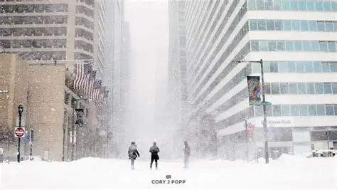
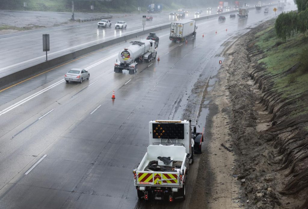
Heavy Rain Across Southern California
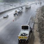
Rain moved into Southern California early Monday, intensifying at times and soaking roadways during peak commute hours.
The National Weather Service issued advisories for heavy rainfall in parts of Los Angeles County, warning of localized flooding and reduced visibility on highways.
Low-lying areas and streets with poor drainage saw pooling water. Drivers were urged to slow down and avoid flooded roadways.
“Even moderate rainfall can create hazardous driving conditions,” a National Weather Service meteorologist said. “People should allow extra time and never drive through standing water.”
Emergency crews monitored flood-prone corridors as runoff increased.
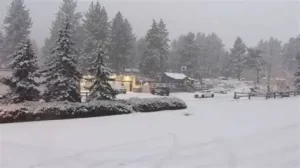
Mountain Snow Creates Dangerous Travel Conditions
Higher elevations experienced significant snowfall as colder air moved into the region.
Mountain communities and major routes through the San Bernardino and Angeles National Forest areas reported accumulating snow, leading to chain requirements and road restrictions.
The California Highway Patrol warned drivers heading into mountain areas to prepare for winter conditions.
“If you’re traveling to the mountains, make sure your vehicle is equipped and check road conditions before you leave,” a CHP spokesperson said. “Conditions can change quickly during active storms.”
Ski areas in Southern California also reported fresh snowfall, though officials emphasized that travel safety remains the priority.
Timeline of the Storm’s Impact
The storm system began moving into the region late Sunday, with rain spreading across coastal and valley communities overnight.
By Monday morning, steady rainfall was falling across much of Los Angeles County. Snow levels dropped as colder air followed the main rain bands.
Throughout the afternoon, bursts of heavier rain and snow developed in waves.
Forecasters say another system could arrive later this week, prolonging unsettled weather across the region.
Flood and Mudslide Concerns in Burn Scar Areas
Areas impacted by recent wildfires remain especially vulnerable.
When heavy rain falls on hillsides stripped of vegetation, water can mix with loose soil and debris, increasing the risk of mudflows.
County emergency management officials advised residents in burn scar zones to stay alert for evacuation notices if conditions worsen.
“Debris flows can happen rapidly during intense rainfall,” a county official said. “Residents in high-risk areas should have a plan in place.”
Authorities have not reported widespread mudslides as of Monday evening but continue to monitor rainfall totals closely.
Public Reaction and Community Response
Residents shared images of snow-covered mountain roads and rain-soaked streets across social media platforms.
Commuters reported slower-than-usual travel times as traffic increased during periods of heavy rainfall.
Some schools in higher elevations monitored conditions closely, particularly where snow accumulation could affect access roads.
Utility crews remained on standby in case of power outages caused by falling branches or saturated soil.
What Happens Next
Meteorologists say the current storm system will gradually move east, but additional rain and snow are expected later this week.
The ground remains saturated in many areas, increasing the risk of localized flooding even with moderate rainfall.
Officials are urging residents to:
-
Monitor local weather alerts
-
Check road conditions before traveling to mountain areas
-
Avoid flooded streets
-
Prepare emergency supplies if living in a flood-prone or burn scar zone
Weather updates are expected throughout the week as new storm systems approach Southern California.
FAQ: Southern California Winter Storm
Is it snowing in Southern California?
Yes. Mountain areas are seeing snowfall, while lower elevations are experiencing rain.
Are roads closed due to the storm?
Some mountain routes have chain requirements or restrictions. Drivers should check local highway updates before traveling.
Is there a flood risk?
Localized flooding is possible, especially in low-lying and burn scar areas.
Will more storms hit Southern California this week?
Forecasters say additional systems are likely later in the week.
Should residents prepare for evacuations?
Evacuation notices depend on local conditions. Residents in burn scar zones should stay alert and have a plan.
How long will the storm last?
The current system is expected to move out, but unsettled weather may continue through the week.
Closing Update
Southern California remains under active weather alerts as rain and snow continue to impact travel and daily routines.
Officials say conditions may shift quickly with additional systems forecast in the coming days. Residents are encouraged to follow local guidance and stay informed as the storm pattern continues.


Leave a Comment