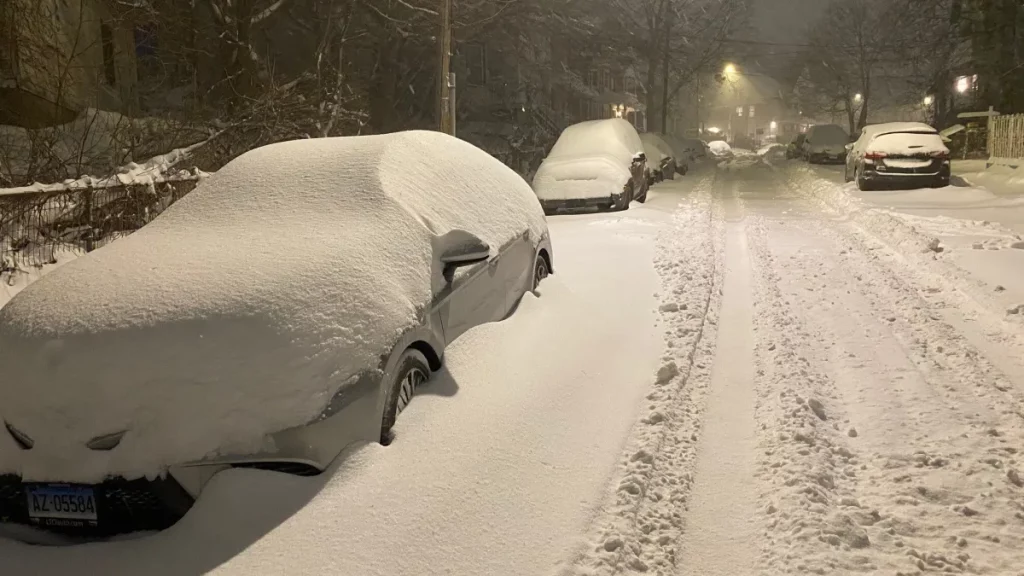
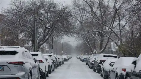
Drivers across the state woke up to icy roads and steady snowfall Friday morning.
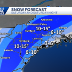
Forecasters say snow will continue through around noon before tapering off, but hazardous travel conditions could linger into the afternoon commute.
The winter weather has created slick surfaces on highways, secondary roads and sidewalks, prompting officials to urge caution. Temperatures remain low enough to keep untreated areas icy.
Looking ahead, a brief thaw is expected Saturday. But the extended forecast suggests a busy weather pattern heading into early March, with additional snow chances possible next week.
Snow Continues Through Midday
Light to moderate snow moved in overnight and persisted into the morning hours.
Road crews have been treating primary routes, but accumulation during peak commute times led to slow travel in several areas.
Meteorologists expect snowfall to diminish around midday, though patchy snow showers could linger in some regions.
The primary concern remains icy conditions, especially on bridges and overpasses.
A National Weather Service meteorologist said in a morning briefing, “Even light snowfall can create dangerous travel when pavement temperatures are below freezing. Drivers should allow extra time and maintain safe distances.”
Hazardous Morning Commute
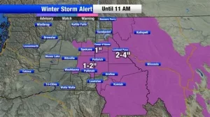
State transportation officials reported reduced speeds on major highways during the early commute.
Secondary roads and residential streets were particularly slick, where plowing operations take longer to complete.
Local law enforcement agencies responded to minor spinouts and fender-benders, though no widespread closures were reported.
Emergency management officials reminded residents to avoid unnecessary travel until road conditions improve.
Brief Saturday Thaw Expected
After Friday’s snowfall tapers off, temperatures are forecast to rise slightly on Saturday.
Forecasters describe the change as a “brief thaw,” with daytime highs climbing above freezing in some areas.
This could allow for melting on treated surfaces, though overnight refreezing remains possible.
Meteorologists caution that melting snow during the day can lead to black ice once temperatures drop again after sunset.
A state climatologist noted, “Short warm-ups in late winter can help with snowpack reduction, but they don’t eliminate the risk of overnight ice.”
Active Pattern Ahead as March Begins
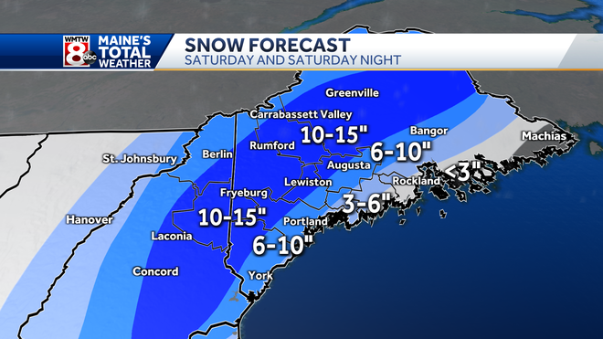
While the weekend may offer a temporary break, forecasters are closely watching a more active pattern setting up for early next week.
Long-range models indicate multiple disturbances could move through the region between early and midweek.
At this stage, it remains unclear whether the state will experience several smaller, disorganized snow events or one more significant storm system.
Forecast confidence typically improves within 48 to 72 hours of a system’s arrival.
Meteorologists emphasize that early March often brings variable conditions, including snow, rain, or mixed precipitation.
Why Early March Can Be Unpredictable
Climatologically, late winter transitions can produce volatile weather setups.
Cold air masses may still linger, while increasing daylight and fluctuating temperatures introduce competing influences.
These dynamics sometimes lead to fast-moving systems that are difficult to track far in advance.
Forecasters continue to monitor evolving atmospheric patterns before issuing specific snowfall projections.
Travel and Safety Recommendations
Transportation officials advise drivers to monitor weather updates and check road conditions before heading out.
Maintaining a winter emergency kit, reducing speed and allowing extra braking distance are common safety recommendations during icy conditions.
Pedestrians are also urged to use caution on untreated sidewalks and parking lots.
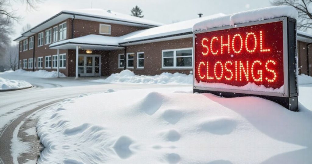
School districts and municipal offices are monitoring conditions to determine whether schedule adjustments are necessary.
Key Weather Facts at a Glance
| Event | Location | Date | Who Is Affected | Current Status | What Residents Should Know |
|---|---|---|---|---|---|
| Morning snowfall and icy roads | Statewide | Friday morning | Commuters, schools, businesses | Snow continuing until noon | Slick conditions may persist |
| Brief thaw | Statewide | Saturday | Residents and travelers | Temperatures rising slightly | Melting possible; watch for refreeze |
| Potential early March snow events | Statewide | Early to mid next week | General public | Forecast developing | Models show active weather pattern |
Public Reaction and Community Response
Social media posts throughout the morning showed images of snow-covered streets and slow-moving traffic.
Some residents expressed concern about the timing of snowfall during peak commute hours.
Others noted appreciation for quick plowing efforts on major roadways.
Local officials have encouraged continued patience as crews work to clear remaining accumulation.
What Happens Next
Snow is expected to taper off around midday, with gradual improvement in road conditions later in the afternoon.
Saturday’s warmer temperatures may offer temporary relief.
Attention then turns to the early-week forecast, when additional systems could bring more winter precipitation as March begins.
Forecasters say updated projections will be available as models become clearer.
Frequently Asked Questions (FAQs)
How long will the snow last today?
Snow is expected to continue until around noon before tapering off.
Will road conditions improve this afternoon?
Conditions should gradually improve, but untreated surfaces may remain icy.
What is a brief thaw?
A brief thaw refers to a short period of above-freezing temperatures that can melt snow and ice.
Is another storm coming next week?
Forecast models show additional snow chances early to midweek, though details are still uncertain.
Could there be one major storm instead of several small ones?
Forecasters say it is too early to determine whether upcoming systems will merge into a larger storm.
How can residents stay updated?
Residents should monitor official weather forecasts and transportation advisories for updates.
Conclusion
Slick roads and steady snowfall created challenging travel conditions statewide Friday morning, with snow expected to taper off by midday.
A short-lived warm-up is forecast for Saturday, but attention is already shifting to early next week as forecasters monitor additional snow chances.
Residents are advised to stay informed as March begins with an active weather pattern developing.


Leave a Comment