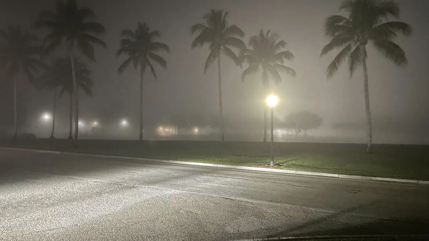
Sarasota and surrounding communities are waking up to another round of dense morning fog.
After a mild and sunny day along Florida’s Suncoast, visibility is expected to drop significantly overnight and into early Friday. Forecasters warn that drivers could encounter visibility as low as one-third of a mile before conditions improve mid-morning.
The weather shift may slow the morning commute in parts of Sarasota County and nearby coastal areas. While the fog will lift, warmer temperatures are set to continue through the weekend before another cold front moves in by Sunday evening.
What Happened Thursday on the Suncoast
Thursday brought near-ideal winter weather across Sarasota and the Gulf Coast.
High temperatures climbed into the upper 60s to low 70s along the beaches. Inland communities saw even warmer readings, reaching the upper 70s and in some spots approaching 80 degrees.
Skies remained partly sunny with a mix of clouds, giving much of the region a comfortable and dry afternoon.
“It’s been an absolutely beautiful day,” local meteorologists at WWSB said in their evening forecast update, describing the mild and calm conditions across the Suncoast.
But that calm pattern is also contributing to overnight fog formation.
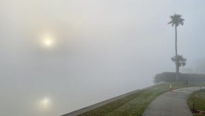
Why Dense Fog Is Developing Again
Forecasters say light winds and lingering surface moisture are allowing fog to redevelop overnight.
When temperatures fall into the mid to upper 50s, moisture near the ground condenses, leading to reduced visibility by early morning. Similar patterns have developed across parts of coastal Florida in recent days.
“Expect more foggy conditions which last through sunrise before wrapping up around 9 a.m.,” WWSB meteorologists said.
In some spots, visibility could drop to around one-third of a mile. That level of visibility is considered hazardous for drivers, especially on bridges, rural roads, and low-lying areas.
The fog is expected to gradually clear as temperatures rise after sunrise.
Timeline: When Conditions Improve
-
Late Thursday Night: Fog begins forming after midnight.
-
Early Friday Morning: Dense fog possible before sunrise.
-
Around 9 a.m.: Fog lifts as temperatures warm.
-
Friday Afternoon: Sunny to partly cloudy skies return.
Once the fog clears, temperatures are expected to rebound quickly.
Beach communities should see highs in the low 70s. Inland areas are forecast to warm into the low 80s by Friday afternoon.
Weekend Forecast: Warm and Dry Before Another Front
The warming trend continues into Saturday and Sunday.
Forecasters expect similar temperature patterns — low 70s along the coast and low 80s inland. Conditions are expected to remain mostly dry through much of the weekend.
However, changes arrive late Sunday.
By Sunday evening, another cold front is forecast to move through the region. The front could bring gusty winds along with scattered showers and thunderstorms.
“By Sunday another cold front will pass our area, bringing windy conditions and scattered storms and showers in the evening,” the WWSB forecast noted.
At this time, no severe weather warnings have been issued. Still, residents are encouraged to monitor updated forecasts heading into Sunday night.
How This Impacts Drivers and Residents
Morning fog can create sudden visibility changes, particularly in areas near water and open fields.
Drivers are advised to:
-
Use low-beam headlights
-
Reduce speed
-
Increase following distance
-
Avoid sudden braking
The National Weather Service routinely advises motorists to “slow down and allow extra travel time when dense fog develops,” particularly during peak commute hours.
For residents planning outdoor weekend activities, conditions look favorable through most of Sunday afternoon. Evening events could be impacted if storms develop.
Key Weather Facts
| Event | Location | Date | Who Is Affected | Current Status | What Readers Should Know |
|---|---|---|---|---|---|
| Dense Morning Fog | Sarasota and Florida Suncoast | Friday Morning | Early commuters, drivers, coastal residents | Expected overnight through 9 a.m. | Visibility may drop to one-third mile before improving |
| Warm Afternoon Temps | Beaches and Inland Areas | Friday–Sunday | Outdoor workers, beachgoers | Continuing | Low 70s coast, low 80s inland |
| Cold Front Arrival | Suncoast Region | Sunday Evening | Residents across Sarasota area | Expected | Windy conditions with scattered storms possible |
Background: Fog Patterns on Florida’s Gulf Coast
Winter and late-season frontal patterns often create ideal fog conditions across the Gulf Coast.
Warm daytime temperatures combined with calm nighttime winds allow moisture to collect near the surface. Coastal counties, including Sarasota, frequently experience patchy to dense fog under these setups.
These events are usually short-lived, clearing within hours after sunrise as temperatures rise and air begins circulating again.
This pattern has repeated several times this season across parts of Southwest Florida.
What Happens Next
Forecasters will continue monitoring visibility levels overnight into Friday morning.
Attention will then turn to Sunday’s incoming cold front, which could bring the next round of unsettled weather to the area.
Residents are encouraged to check updated local forecasts before the weekend ends.
FAQ: Suncoast Fog and Weekend Weather
1. How long will the fog last Friday morning?
Fog is expected to last through sunrise and should clear by around 9 a.m.
2. How low could visibility get?
In some areas, visibility could drop to approximately one-third of a mile.
3. Will Friday afternoon be warm?
Yes. Coastal areas will reach the low 70s, while inland areas could see low 80s.
4. Is severe weather expected Sunday?
At this time, only scattered storms and windy conditions are forecast. No severe alerts have been issued.
5. Will the weekend be mostly dry?
Yes. Most of Saturday and Sunday daytime hours are expected to remain dry.
6. Should drivers change their plans Friday morning?
Drivers should allow extra travel time and use caution during periods of dense fog.
Conclusion
Foggy conditions are set to return to Sarasota and the Suncoast early Friday, potentially impacting the morning commute before clearing mid-morning. Warm temperatures will continue into the weekend, with another cold front expected to arrive Sunday evening bringing wind and scattered storms.
Residents should monitor updated forecasts and use caution during periods of reduced visibility.


Leave a Comment