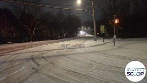
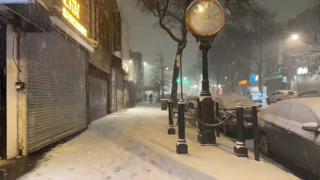
Snow is set to fall across parts of Massachusetts overnight, and some schools are already adjusting schedules.
Forecasters say a fast-moving “clipper system” will bring between 1 and 4 inches of snow Tuesday night into early Wednesday. The timing could make for a slippery morning commute.
At least one school district has canceled classes for Wednesday, Feb. 11, while several others have announced delayed openings.
A winter weather advisory remains in effect for multiple counties as road conditions are expected to deteriorate during the evening and early morning hours.
KEY FACTS AT A GLANCE
| Event | School closings and delays due to overnight snow |
|---|---|
| Location | Massachusetts (Berkshire, Franklin, Essex, Middlesex, Suffolk, northern Worcester counties) |
| Date | Tuesday night into Wednesday, Feb. 11 |
| Who Is Affected | Students, parents, school staff, commuters |
| Current Status | Winter Weather Advisory in effect until early Wednesday |
| What Readers Should Know | 1–4 inches of snow expected; slippery roads likely for morning commute |
WINTER WEATHER ADVISORY ISSUED ACROSS MASSACHUSETTS
The National Weather Service issued a winter weather advisory for Berkshire, Franklin, Essex, Middlesex, Suffolk and northern Worcester counties.
The advisory remains in effect until early Wednesday morning.
Forecasters expect snowfall totals between 2 and 4 inches in many of those areas. Some locations could see lighter amounts closer to 1 inch, depending on how the system tracks.
The concern isn’t just snowfall totals. It’s timing.
Snow is expected to fall during the Tuesday evening commute and continue into the early hours of Wednesday, potentially creating slick roads just as drivers head out for work and school.
“Even a few inches can cause travel problems when it lines up with peak commute times,” a National Weather Service meteorologist in Boston said Tuesday afternoon. “Drivers should plan for reduced visibility and slippery conditions overnight and early Wednesday.”
WHAT IS A CLIPPER SYSTEM?
The storm moving through Massachusetts is described as a “clipper system,” a fast-moving area of low pressure that typically forms in Canada and tracks southeast.
Clippers tend to move quickly. They usually don’t bring heavy, long-duration snowfall. But they can deliver bursts of moderate snow that accumulate quickly in a short window.
Because they move fast, conditions can change in a matter of hours.
In this case, forecasters said the system is expected to exit the region by early Wednesday, but not before leaving behind enough snow to impact travel.
SCHOOL CLOSINGS AND DELAYED OPENINGS
At least one school district announced a full closure for Wednesday, Feb. 11, citing expected road conditions.
Several others opted for delayed openings, giving road crews additional time to treat streets and clear snow before buses begin routes.
School officials often make these decisions based on overnight forecasts, road treatment schedules and coordination with local public safety departments.
A superintendent in western Massachusetts said in a statement that student safety remains the priority.
“We’re monitoring road conditions closely,” the superintendent said. “Given the timing of the snowfall and the expected slick spots in the morning, a delay gives our crews time to ensure safer travel for students and staff.”
Parents across affected counties have been checking district websites and automated alert systems for updates.
IMPACT ON THE WEDNESDAY MORNING COMMUTE
Snowfall during the late evening and overnight hours can lead to untreated roadways by morning.
State and local crews typically pretreat highways and major roads ahead of expected snow. Secondary roads and neighborhood streets may take longer to clear.
The National Weather Service warned that slippery road conditions are likely, particularly in areas expecting 2 to 4 inches.
Visibility could also be reduced during heavier bursts of snow.
Officials are urging drivers to slow down, allow extra travel time and maintain safe distances between vehicles.
CONDITIONS BY REGION
Western Massachusetts:
Berkshire and Franklin counties are under the advisory, with snowfall totals closer to the higher end of the forecast range possible.
Greater Boston and Eastern Massachusetts:
Essex, Middlesex and Suffolk counties are also included. Urban areas may see quick accumulations on untreated surfaces.
Northern Worcester County:
Communities here could experience moderate snowfall overnight, leading to slick early morning conditions.
Temperatures are expected to hover near freezing during the event, which increases the risk of icy patches on bridges and overpasses.
PUBLIC RESPONSE AND PREPARATIONS
Residents have been preparing for the quick-hitting storm by salting walkways and adjusting Wednesday schedules.
Grocery stores in some communities reported a modest uptick in foot traffic Tuesday afternoon as people picked up last-minute essentials.
Public works departments across the state said crews are ready.
A spokesperson for a central Massachusetts highway department said, “Our teams are prepared to respond overnight. We’ll be monitoring conditions and treating roads as needed.”
Though the storm is not expected to be a major winter event, officials emphasize that even minor snowfalls can create hazards if drivers aren’t cautious.
WHAT HAPPENS AFTER THE STORM?
Forecasters expect the clipper system to move out by early Wednesday.
Road conditions should gradually improve later in the morning as plows and treatment crews complete their work.
No prolonged storm system is currently forecast immediately after this event, though winter conditions remain possible as February continues.
Residents are encouraged to monitor updated forecasts in case snow totals shift slightly before the system exits.
FAQ: MASSACHUSETTS SCHOOL CLOSINGS AND SNOW FORECAST
How much snow is expected in Massachusetts?
Between 1 and 4 inches, depending on location.
Which counties are under a winter weather advisory?
Berkshire, Franklin, Essex, Middlesex, Suffolk and northern Worcester counties.
Why are schools closing for only a few inches of snow?
The snowfall is expected overnight, which could create slick conditions during the morning commute.
When will the snow stop?
Forecasters expect snow to taper off by early Wednesday morning.
Will roads be icy?
Yes, especially untreated roads, bridges and overpasses.
Should commuters plan extra time?
Officials recommend allowing extra travel time and driving cautiously Wednesday morning.
CONCLUSION
A fast-moving clipper system is expected to bring light to moderate snowfall across parts of Massachusetts Tuesday night into early Wednesday.
While totals are forecast between 1 and 4 inches, the overnight timing could lead to slippery roads during the Wednesday morning commute. Some schools have already announced closures and delays as a precaution.
Residents should continue monitoring local district announcements and weather updates as the system moves through the state.


Leave a Comment