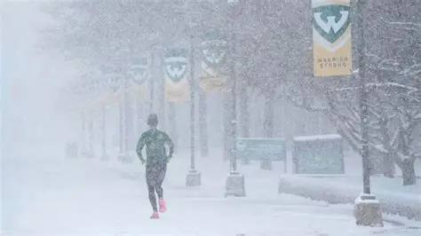
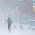
Snow is set to return to Central New York.
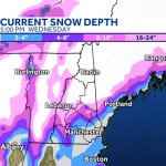
The National Weather Service has updated a winter weather advisory warning that parts of the region could see up to 6 inches of snow beginning Wednesday afternoon. The system is expected to create slick travel conditions through the evening and possibly into early Thursday.
For commuters and school districts, timing is key. The heaviest snowfall may overlap with the late-day drive.
Forecasters say residents should prepare for reduced visibility and snow-covered roads as the next round of winter weather moves in.
Winter Weather Advisory Issued for Central New York
The National Weather Service (NWS) has placed portions of Central New York under a winter weather advisory ahead of the approaching system.
Advisories are typically issued when accumulating snow is expected to cause travel difficulties but does not meet warning-level criteria.
According to forecasters, snowfall totals could reach as much as 6 inches in some communities, with lower amounts in others depending on exact storm track and temperature profiles.
“Plan on slippery road conditions,” the NWS said in its advisory statement. “The hazardous conditions could impact the Wednesday evening commute.”
When Will Snow Start in Central NY?
Snow is expected to begin Wednesday afternoon, initially falling at a light to moderate rate.
As the system strengthens, steadier snowfall may develop later in the day. Forecasters say accumulation could increase quickly before sunset.
The most consistent snow is projected during the late afternoon and evening hours.
Overnight Wednesday into early Thursday, lingering snow showers may continue before gradually tapering off.
How Much Snow Could Central NY Get?
Current projections indicate totals ranging from several inches to as much as 6 inches in harder-hit areas.
Localized variations are possible. Elevation and snowfall intensity bands can lead to differences from one neighborhood to another.
Meteorologists caution that small shifts in the system’s path could slightly adjust final totals.
While 6 inches is the upper-end estimate, even 3 to 4 inches during peak travel hours can cause significant disruptions.
Timeline of the Midweek Snowstorm
Wednesday Morning: Mostly cloudy skies. Snow not yet widespread.
Wednesday Afternoon: Snow develops across Central New York. Light accumulation begins.
Wednesday Evening: Periods of steady snowfall. Roads become snow-covered and slippery.
Late Wednesday Night: Snow gradually weakens but may continue in scattered areas.
Thursday Morning: System tapers off; cleanup and plowing operations continue.
Travel conditions are expected to improve gradually after the storm exits.
Impact on Travel and Local Communities
The advisory highlights concerns about hazardous driving conditions.
Snow falling during the late afternoon and evening commute may reduce visibility and limit traction, particularly on untreated surfaces.
Bridges and overpasses typically freeze first.
Local transportation departments often prepare plow crews in advance of advisory-level storms.
“We’ll have crews out treating and clearing roadways as the snow moves in,” a regional transportation spokesperson said during a previous winter event. “Drivers should give themselves extra time and maintain safe following distances.”
Airports in the region could experience minor delays depending on snowfall intensity.
School officials may monitor overnight conditions before deciding on any schedule adjustments for Thursday morning.
Why This Storm Matters in Midwinter
February remains one of the snowiest months in Central New York.
Climatological averages show that midseason systems frequently deliver moderate snowfall events similar to this one.
Although this storm is not forecast to reach blizzard criteria, its timing during active travel periods increases its impact.
Even modest accumulation can lead to traffic slowdowns and isolated accidents if drivers are unprepared.
Emergency management officials routinely advise residents to keep winter supplies in vehicles and limit unnecessary travel during peak snowfall.
Official Forecast and Safety Recommendations
The National Weather Service continues to monitor the developing system and will issue updates as needed.
Forecasters encourage residents to check the latest snowfall maps and advisory details.
“Slow down and use caution while traveling,” the NWS advisory states. “Keep updated with the latest forecast information.”
Residents are advised to:
-
Allow extra travel time
-
Clear snow from vehicles before driving
-
Stay informed through local weather alerts
Municipal plow crews are expected to treat priority routes first before moving to secondary roads.
Public Reaction Across Central New York
Many residents have grown accustomed to February snow.
On social media, some welcomed the fresh accumulation, while others expressed concern about midweek travel disruptions.
Local businesses are preparing for potential delays but have not announced widespread closures as of early Wednesday.
Weather remains a routine but closely watched factor in the region’s winter months.
Central NY Winter Weather Advisory Summary
| Event | Winter Weather Advisory |
|---|---|
| Location | Central New York |
| Date | Beginning Wednesday afternoon |
| Who Is Affected | Commuters, schools, businesses, air travelers |
| Expected Snowfall | Up to 6 inches in some areas |
| Current Status | Advisory issued; snow expected Wednesday afternoon |
| What Readers Should Know | Slippery roads likely during evening commute; monitor forecast updates |
Frequently Asked Questions
How much snow will Central New York get Wednesday?
Forecasters say up to 6 inches is possible in some areas, with lower totals elsewhere.
When will the snow start?
Snow is expected to begin Wednesday afternoon and intensify later in the day.
Will the evening commute be affected?
Yes. The heaviest snowfall may coincide with the late afternoon and evening drive.
Is this a winter storm warning?
No. The National Weather Service has issued a winter weather advisory.
When will the snow stop?
Snow is expected to taper off late Wednesday night or early Thursday morning.
Could snowfall totals change?
Yes. Slight adjustments to the storm track could affect accumulation amounts.
Should residents prepare for power outages?
At this time, widespread outages are not expected, but isolated issues are always possible during winter weather.
What to Watch Next
Snow is forecast to begin Wednesday afternoon and continue into the night before gradually diminishing.
Residents should monitor National Weather Service updates for any changes in snowfall totals or advisory status.
Road crews will work overnight to clear major routes, and travel conditions should improve as the system moves out.
Additional winter systems remain possible as February continues

Leave a Comment